HTML Geolocation API
The Geolocation API lets websites access the user’s location (with permission). This is widely used in maps, food delivery apps, ride-booking, and weather updates.
Key Features:
- Access the user’s current location (latitude & longitude)
- Requires user permission for privacy.
- Can work with GPS, Wi-Fi, or mobile networks.
How Does the Geolocation API Work?
The API is available through the navigator.geolocation object in JavaScript.
It mainly has three methods:
getCurrentPosition()→ Get the current location once.watchPosition()→ Track location continuously in real time.clearWatch()→ Stop tracking location.
Getting User Location (Latitude & Longitude)
Here’s a simple example of getting the current position:
<button onclick="getLocation()">Get My Location</button>
<p id="output"></p>

<script>
function getLocation() {
  if (navigator.geolocation) {
    navigator.geolocation.getCurrentPosition(showPosition, showError);
  } else {
    document.getElementById("output").innerText = "Geolocation is not supported in this browser.";
  }
}

function showPosition(position) {
  document.getElementById("output").innerHTML =
    "Latitude: " + position.coords.latitude +
    "<br>Longitude: " + position.coords.longitude;
}

function showError(error) {
  switch(error.code) {
    case error.PERMISSION_DENIED:
      alert("User denied location request.");
      break;
    case error.POSITION_UNAVAILABLE:
      alert("Location information unavailable.");
      break;
    case error.TIMEOUT:
      alert("Location request timed out.");
      break;
    default:
      alert("An unknown error occurred.");
  }
}
</script>
Tracking User Location in Real Time
If you want to continuously monitor location (like in ride-tracking apps), use watchPosition().
let watchId = navigator.geolocation.watchPosition(pos => {
  console.log("Latitude:", pos.coords.latitude,
              "Longitude:", pos.coords.longitude);
});
Error Handling in Geolocation API
Errors can happen if:
- The user denies permission
- The device cannot detect location
- The request times out
That’s why error callbacks are important (as shown in the example above).
Browser Support & Limitations
Supported by most modern browsers (Chrome, Edge, Firefox, Safari).
Requires HTTPS (except on localhost).
Accuracy depends on the device → GPS is more accurate than Wi-Fi or IP.
Security & Privacy Concerns
- Browsers always ask permission before sharing location.
- Never collect more data than needed.
- Always explain why your app needs location.
- Handle sensitive location data securely.
Real-World Use Cases
- Maps & Navigation – Google Maps, Apple Maps
- Food Delivery – Track orders in real-time
- Ride-Hailing – Ola, Uber live ride tracking
- Weather Apps – Show weather based on location
- Fitness Apps – Track running or cycling routes
Geolocation API vs Third-Party APIs
The built-in Geolocation API is simple and free, but limited.
For advanced features, developers often use:
- Google Maps API – Rich maps, directions, geocoding
- Mapbox API – Custom maps with styles
- OpenStreetMap API – Free and open-source mapping
HTML5 Geolocation API Example – Get & Track User Location
<!DOCTYPE html>
<html lang="en">
<head>
<meta charset="UTF-8">
<meta name="viewport" content="width=device-width, initial-scale=1.0">
<title>HTML Geolocation API Example</title>
</head>
<body>
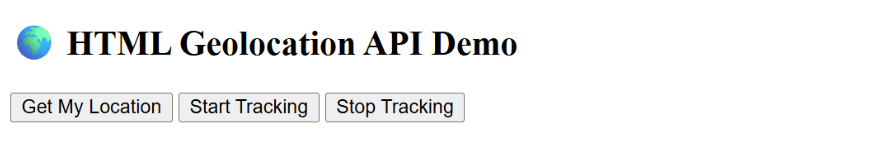
<h2>🌍 HTML Geolocation API Demo</h2>
<button onclick="getLocation()">Get My Location</button>
<button onclick="startTracking()">Start Tracking</button>
<button onclick="stopTracking()">Stop Tracking</button>
<p id="output"></p>
<script>
let watchId;
// 1. Get current location once
function getLocation() {
if (navigator.geolocation) {
navigator.geolocation.getCurrentPosition(showPosition, showError);
} else {
document.getElementById("output").innerText =
"❌ Geolocation is not supported in this browser.";
}
}
// Show latitude & longitude
function showPosition(position) {
document.getElementById("output").innerHTML =
"✅ Current Location:<br>" +
"Latitude: " + position.coords.latitude + "<br>" +
"Longitude: " + position.coords.longitude;
}
// Handle errors
function showError(error) {
switch (error.code) {
case error.PERMISSION_DENIED:
alert("❌ User denied the location request.");
break;
case error.POSITION_UNAVAILABLE:
alert("❌ Location info unavailable.");
break;
case error.TIMEOUT:
alert("⏳ Location request timed out.");
break;
default:
alert("⚠️ An unknown error occurred.");
}
}
// 2. Track location continuously
function startTracking() {
if (navigator.geolocation) {
watchId = navigator.geolocation.watchPosition((pos) => {
document.getElementById("output").innerHTML =
"📍 Tracking...<br>" +
"Latitude: " + pos.coords.latitude + "<br>" +
"Longitude: " + pos.coords.longitude;
}, showError);
}
}
// 3. Stop tracking
function stopTracking() {
if (watchId) {
navigator.geolocation.clearWatch(watchId);
document.getElementById("output").innerText =
"⏹️ Tracking stopped.";
}
}
</script>
</body>
</html>
Output :